Let's Get Started
Comprehensive Solutions for Visualizing and Managing Geographic Data
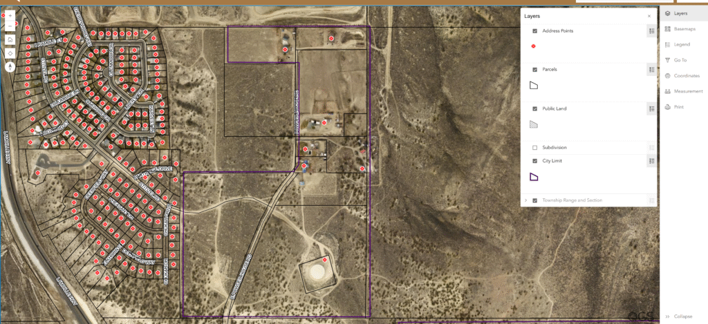
At Q Geospatial Solutions (QGS), we transform complex spatial data into powerful, actionable insights. By combining advanced GIS technology with extensive industry expertise, we deliver tailored mapping solutions that empower local governments, urban planners, and infrastructure managers to make smarter decisions. Our services optimize resources, streamline operations, and drive sustainable growth, ensuring your projects succeed in the geospatial world.
4.9 / 5.0


Clients Served
Trusted by global companies


Our Expertise
Our Expertise in different Domains
02
🏛 Local Government
01
⚡ Utilities
03
🌍 Environmental
Our Services
GIS Mapping Services
Full GIS Project Lifecycle
We guide you through the entire GIS project lifecycle, from planning and design to analysis, mapping, delivery, and ongoing maintenance, ensuring a seamless and effective solution.
GIS System Administration
Monitor and maintain the performance and security of the GIS system, ensuring optimal uptime and data integrity.
Collaboration
Work with various individuals, including IT staff, and GIS technicians to ensure successful GIS implementation and utilization.
Infrastructure Management
Help oversee the hardware, software, and network infrastructure required for the GIS, including servers, databases, and applications.
Data Conversion
Transforming spatial data, such as coordinates, maps, or geographic information, from one format, coordinate system, or projection to another to ensure compatibility and accuracy in mapping or analysis.
Utility Networks
Specialize in creating and implementing utility networks to streamline the management of critical infrastructure like water, gas, and electric systems. Using GIS, I design digital models that map and analyze utility assets, enabling efficient planning, maintenance, and emergency response.
ArcGIS Enterprise/Online
Specialize in leveraging Esri’s powerful GIS platforms to transform your organization’s spatial data into actionable insights. With expertise in architecture, implementation, and administration, I provide tailored solutions, from deploying scalable ArcGIS Enterprise systems to optimizing ArcGIS Online for cloud-based collaboration. Services include geodatabase optimization, custom application development, and migration support, ensuring seamless integration and enhanced decision-making. Whether modernizing workflows or streamlining operations, I deliver practical, industry-specific GIS strategies to maximize your investment and drive efficiency.
GIS Development
Design and implement tailored mapping tools, interactive visualizations, and geospatial databases to address unique client needs. I deliver scalable, user-friendly GIS applications that enhance decision-making, optimize workflows, and unlock the power of location intelligence.
Services
GIS Services & Deliverables

Geocoding
Data Conversion
Utility Network
GeoSpatial Analysis
GeoSpatial Data Services
ArcGIS Enterprise/Online
GIS Development
Why Outsource?
Why Outsource GIS Mapping Services?
Partner with Q Geospatial Solutions (QGS) to elevate your geospatial projects with unmatched expertise and precision. Our certified GIS professionals deliver tailored solutions—accurate maps, 3D models, and spatial analytics—that drive smarter decisions and measurable results. Using cutting-edge tools like ArcGIS Pro, Enterprise, SDKs, and AI-driven analytics, as we ensure compliance with regulations and deliver scalable outcomes for infrastructure, governance, and sustainability. Outsource to QGS for cost-effective, high-impact geospatial intelligence that empowers your organization.
- Saves you your time and money
- Gives you access to experts
- Keep your current system architecture, data and maps, and complied code on your data systems.
- Get access to advanced technologies and tools

How It Works
Your Project is Ready in 4 Easy Steps
Our step-by-step guide to social success outlines a clear process to elevate your brand.
01
Data Collection
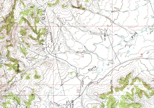
Firstly, we need data from various sources. GIS mapping services use various data sources such as satellite imagery, census reports & GPS data to create maps. The data collected is then analyzed to create accurate and detailed map products.
02
Map Creation
03
Integration
04
Customization
Why choose us?
Why choose Us?
Renowned Standing
Due to skills we hold, both large and small roll-out firms want to benefit from our knowledge and expertise.
Modern Tech Solutions
We use high-tech solutions to understand design and construction requirements for GIS Mapping Services.
Quick Turnaround Time
Timely actions and efficient outputs minimize delays, maximize productivity & ensure prompt GIS mapping services for our clients.
Lower your costs
Optimize your budget and maximize value with our cost-efficient solutions. Our advanced methodologies and innovating tools streamline operations, enabling you to achieve superior outcomes without overburdening your team or resources. We transform cost-efficiency into a dynamic pursuit of exceptional value, ensuring your project delivers measurable results while adhering to financial constraints.
High Competent Staff
Our highly skilled and competent staff bring unparalleled expertise to every project, setting us apart in the industry. With extensive experience in geospatial analysis, development, and project management, our team delivers innovative, precise, and compliant solutions tailored to your needs. With a proven track record across diverse projects, ensures exceptional outcomes that drive success and exceed client expectations.
Advancing the field of GIS Mapping services
We are committed to advancing the field through innovative, high-precision geospatial solutions. Serving clients throughout Nevada, our expertise encompasses the full GIS project lifecycle, from data acquisition to spatial analysis and visualization.
Q Geospatial Solutions
Why Outsource GIS Mapping Services?
- Saves you your time and money
- Gives you access to experts
- Keep your designs, maps & 3D models complied with codes and regulations
- Get access to advanced technologies and tools

Grow With Us!
Turn Data into Decisions with QGS Now!
From infrastructure to sustainability, we provide the geospatial intelligence you need to make smarter moves.

FAQ's
Frequently Asked Questions
At QGS, we offer a comprehensive suite of GIS services, including expert consulting, data and spatial analysis, custom map creation, and tailored GIS training for all skill levels, designed to deliver precise, actionable solutions for your projects. What sets us apart is our dedication to customers and their project needs.
To start a GIS mapping project, schedule a consultation with us to discuss your project requirements & we’ll develop a detailed plan and timeline.
Yes, our digital GIS mapping services provide outputs in formats compatible with your existing GIS systems for seamless integration and use.
GIS is versatile and beneficial across many sectors, including urban planning, environmental conservation, public safety, healthcare, real estate, mining, and transportation.
Yes, we provide GIS mapping services for both small & large-scale projects, ensuring accurate & detailed spatial analysis for any project size.
We offer ongoing support and maintenance services to ensure your GIS solutions continue to operate smoothly and remain updated after your project completion. Talk to us about our maintenance plans.
2007
Founded
100 +
Projects Completed
5 Million +
Database Files Maintained
